Ranaghan
Westmeath apopted Town plan
Introduction
Ranaghan an area south of Lough Lene, north of Lough Derravaragh in the nort of Westmeath is an area doted with a multitude of Ring forts and doons, from pre christian neolithic times.
Ringforts are fortified settlements that are generally agreed to be from the Early Medieval Period in Northern Europe, especially Ireland. They are also known as ráth, caiseal, cathair and dún in the early Irish sources. A ráth (anglicised rath), was made of earth, caiseal (northwestern Ireland, anglicised cashel) and cathair (southwestern Ireland) were built of stone. A dun is a more prestigious site, the seat of some kind of ruler, the term is applied to promontory forts as well.
In terms of quantity, distribution and access, no historical or archaeological record of the Early Medieval Period in Ireland comes close to the ringfort. Over 50,000 sites have been identified as ringforts throughout Ireland and it is generally accepted that in the region of 60,000 ringfort sites can be identified. It is probable that due to intensive farming methods, the levelling of field and expansion of urban areas than many more were originally built but have been lost to us today, but through the use of early Ordnance Survey maps and aerial photography many previously unknown ringforts have been discovered. Also, the extensive archaeological work that has accompanied the large road building programs in Ireland have uncovered many unknown ringforts and will probably continue to do so.
Despite regional variations in the density of ringforts particularly in the areas of Westeath and traditional Leinster where there are comparatively high number of ringforts, built from clay soil and wood, and they are generally a feature common throughout the country, with a mean density of just over one ringfort within any area of 2km². Despite their number, consensus has yet to be reached on two of the principle issues relating to ringforts, firstly, when they were built and secondly, what precisely their function might have been.
They have been easier to identify in rockey areas of poor soil as these stones were employed within the ring defence wall. Contrary to the West of Ireland the Hill of Tara, (also a ring fortress) which was constructed from clay and most likely different types of wood, long since which returned to the earth by rotting.
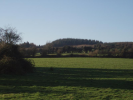
Randoon Fort, Ranaghan

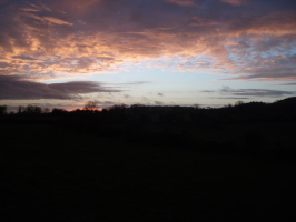
Gaelic Sky Ranaghan
Historical Interests
Ranaghan and areas south of Lough Lene have been an inhabited area from pre-Christian times, proven by the presence of a multitude of Ringforts many now over grown, and other historic relics, may be visited in the surrounding high ground surrounding Lough Lene.
The area also boasts of ancient burial-grounds associated with Saint Colman who was responsible of 7 early christian cells, of which Lene and Carric, are near by, and during peanal times there are the christian mass paths, and styles by which pilgrims travelled on foot through fields to Sunday mass.
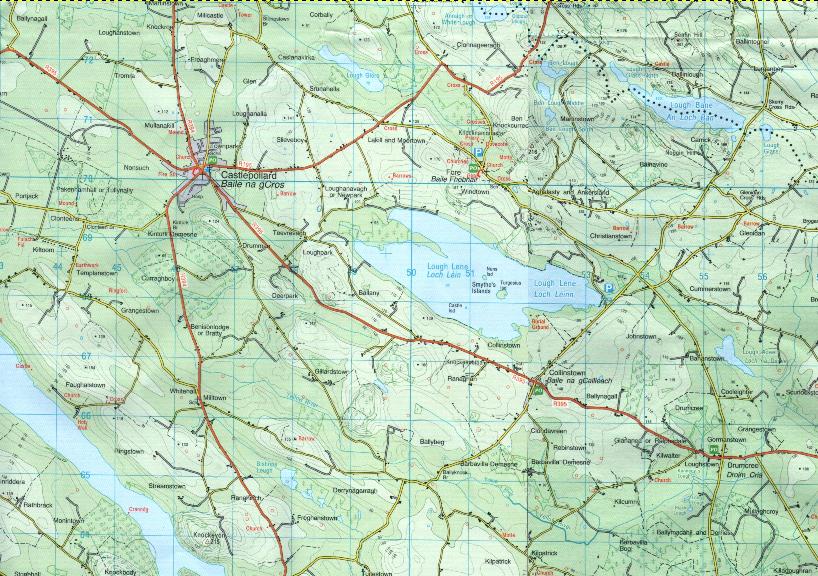
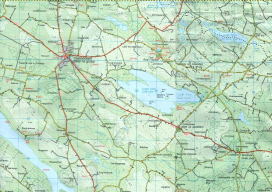
Turgesius the viking had a fortress built upon the major Lough Lene island nearby. These historical relics and others, are clearly marked upon the ordinance survey maps no. 41 & 42 of the Ordinance Survey maps of Ireland (OSI).
West of Collinstown in the Ranaghan area, and south-west of Lough Lene, remain today different ringforts of which at least one is attributed to the tyrant Viking, Turgesius. From the high ground they overlook the lake and were easy to defend. Legend has it that he dwelled here before being killed by Melaghlin or Malachy the local Meath /Westmeath chieften. In addition to this fort, Turgesius also had another upon the biggest island of Lough Lene which still today bears his name, Turgesius Island.
Collinstown also has close historic links with the religious orders, the irish name Baile na gCailleach associated to the Nuns convent upon the second island on Lough Lene, and finally, the saint Taurin, saint Fechan, and Evreux Benedectine monks who came from Normandy, associated with [[Fore Abbey]].
The above mentioned ringforts, and recorded protected structures are marked with small turquoise circles here in the village plan:
Collinstown plan
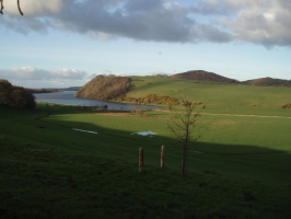
Lough Lene Map
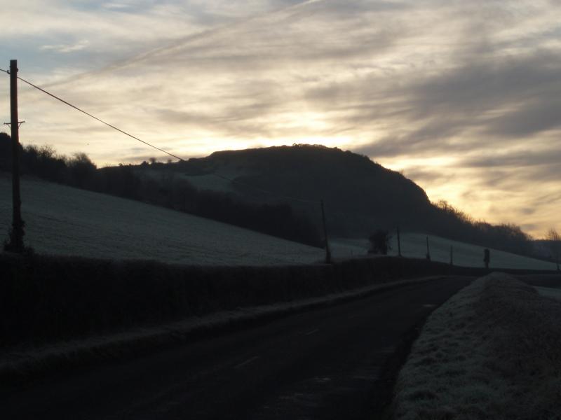
Ranaghan view of Knockeyon
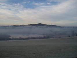
Knockeyon Lough Derravaragh Westmeath
External Links
Westmeath County Council
Ordenance Survey of Ireland (maps no. 41 and no.42)
Viking Ireland Network school project
Lough Lene Monks Boat
Associated L.Lene boat text
Lough Lene Gaels
Loughs of Westmeath
St. Colman (Colman Mac Luachain 6th/7th century)
Betha Colmain Maic Luachain, or, The Life of Colman son of Luachan
Town of Westmeath
Made with the Bluefish HTML
editor Linux fedora core 3
Peter.Gavigan@lough-lene.eu
Subject=http://www.lough-lene.eu">